


-
AllAnytime Fitness Gym Art Beer Of The Week Blog Bus Fares Bus Service Business Business Expo C2C Care Care Home Charity Children Christmas Cinema City Status Cliffs Pavilion Cliffs Pavilion Review Cocktail Recipes College Community Competition Construction Coronation Coronavirus Dannielle Emery Design Easter Education Electoral changes Leigh on sea Emma Smith Employment Emsella Chair Environment Essex & Suffolk Water News Essex Police Essex Wildlife Trust News Events Family Fun Fashion Festival Film Finance Fitness Food Food & Drink Football Foulness Bike Ride Fresh Face Pillow Company Gardening General Election Hair & Beauty Halloween Harp Havens Havens Hospice Havens Hospices Havens Hospices Health & Fitness Health & Beauty Health & Fitness Healthwatch Southend Historicaleigh History Holidays Housing Indian Indirock Jubilee Karen Harvey Conran Kids Kids Blogs Kids Competitions Kids Reviews Lazydays Festival Legal Legal Eagle Leigh Art Trail Leigh Folk Festival Leigh Library Leigh On Sea Finds Leigh Road Leigh Town Council Leigh Town Council Press Release Leigh on Sea Leigh on Sea Sounds Leigh on sea Folk Festival Leigh on sea Marathon Leigh on sea Town Council Leigh on sea man breaks marathon record Leigh on sea news Lifestyle Livewell Southend Press Release LoS Shop London London Southend Airport Los Shop Marathon Melinda Giles Mortgage Angel blog Mortgages Motherofalloutings Mughal Dynasty Music My Mortgage Angel MyLoS NHS News News Newsletter Offers Outfit Of The Week Palace Theatre Parenting Parking Pets Picture Of The Week Pier Politics Press Release Press Release Southend City Council Professional Property Property Of The Week RSPCA Ray Morgan Re:loved Recipes Recycling Restaurant Restaurant Review Restaurants Review Roads Rotary Club Royal Hotel Royal Visit SAVS Schools Seafront Shopping Shows & Music Review Shows & Music Shows & Music Review Southend Southend Airport Southend Borough Council Press Release Southend City Bid News Southend City Council Southend City Council Press Release Southend City Council Press Release Southend Community Safety Southend Hospital News Southend In Sight Southend In Sight Southend In Sight Press Release Southend on Sea Sport The Mortgage Mum The One Love Project The Ship Hotel Theatre Theatre Blog Theatre Review Theatre review Transport Travel Travel Veolia Village Green Volunteer Weddings Whats On c2c
Historicaleigh: Leigh On The Map
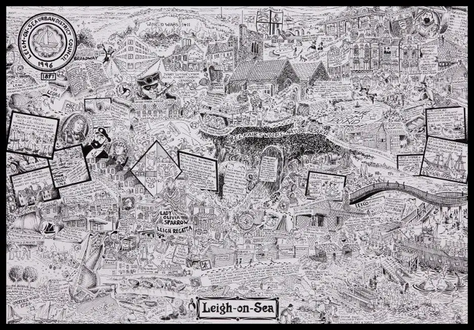
Leigh On The Map
We all know that Leigh supplied several ships for Drake’s Fleet to fight the Spanish Armada and we know from the records that Leigh was a ship building centre. But how did the rest of the world see us?
On 20 May 1570, Gilles Coppens de Diest at Antwerp issued Ortelius’ Theatrum Orbis Terrarum, the "first modern atlas" (of 53 maps), and Leigh (or Ley) is on this map – on the north Thames only Tilbury ? Embarkation point ? and Hadleigh ? famous Castle ? and Leigh are mentioned – so there must have been something going on here which made Leigh important enough to be on the map – could it be this very clever Belgian knew full well the capabilities of this little town?
Ironically I purchased a copy of this map at the Escorial Palace, Phillip II's seat of power in Spain from where the Armada was planned.
This article is by Carole Mulroney from https://www.leigh-on-sea.com/leigh-lives-leigh-on-sea.html
ADD A COMMENT
Note: If comment section is not showing please log in to Facebook in another browser tab and refresh.
Related Items
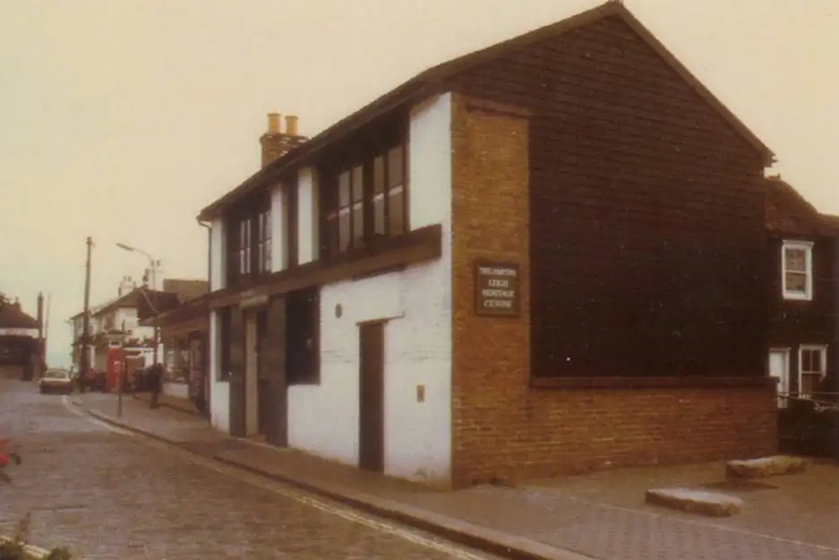
Historicaleigh: Leigh Society and Leigh Heritage Centre
.webp)
If you live in Leigh you cannot have failed to visit the Old Town – and...
HistoricaLeigh: A Distressed Gentleman of Leigh
Carole Mulroney, founder of Leigh Lives, uncovers the history of John Os...
Why I love Leigh: Carole Mulroney
Carole Mulroney loves all things Leigh and is very involved in local tow...